





Developed for high frequency and high demand aerial survey tasks
Fixed-wing VTOL design for large-scale mapping — map fields of 533 hectares in an hour with centimetre-level positioning and quality geographic data.
Remote Sensing Drone
A vast field captured in a blink WATCH INTRO VIDEO
Developed for high frequency and high demand aerial survey tasks
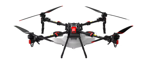
With the fixed-wing VTOL design, XAG M2000 Remote Sensing Drone is developed for high frequency and high demand aerial survey tasks of multiple scenarios, which allows one person to map fields of 533 hectares in an hour¹. Equipped with XAG SuperX 4 Pro Intelligent Control System, the XAG M2000 is capable of accessing quality geographic data, which helps build up digital field maps stably and rapidly to facilitate production decisions. Accurate & Autonomous Flight RTK Centimetre-Level Positioning Automated Flight Planning Sophisticated & Stable Imaging XCam 20MP Pro Gimbal Camera XCam 26MP APS-C Gimbal Camera XCam 20H Hybrid Gimbal Camera XCam 20M Multispectral Gimbal Camera Flexible Take-off and Landing Fixed-Wing VTOL Design Quick Release Body Safe & Efficient Images Stitching Cluster Cloud Computing with Encryption Post Processed Kinematic
VTOL for flexible and efficient flight
The quick assembly XAG M2000 can be immediately deployed for operations. The combination structure of multiple rotors and fixed wings allows flexible take-off and landing. 3 kg EPP fuselage plus the high-energy-density battery provide up to 90 minutes flight time and a range of 86 kilometers in a single flight.
Outsmart, outperform, outsprint
The SuperX 4 Pro Intelligent Control System endows XAG M2000 the power of fully autonomous flight at cm-level accuracy while capturing high-resolution images. With a built-in emergency response mechanism, it monitors the drone’s flight status in real time, and supports quick swapping between multi-rotor and fixed-wing flight modes, ensuring flight safety and survey efficiency.
B6180 Smart Battery
8000mAh Large Capacity 90 mins Battery Life⁸ Smart Battery Management System
Cameras To Multi-application, Fast Switch
Featured with 3-axis mechanical stabilized gimbal and mechanical shutter max out at 1/2000 sec., all cameras can take photos at high-speed without rolling shutter effect. Anti-distortion and autofocus lens contributes to high-resolution imaging. XCam 20MP Pro Gimbal Camera 20 MP 1" CMOS Sensor, high-resolution imaging DSLR-level ISP, ensures high image quality Ground Control Point-Free XCam 26MP APS-C Gimbal Camera⁹ 26 MP APS-C CMOS Sensor, better image quality Photos in Five Directions, supports 3D modeling 0.4s Shooting Interval, improve mapping efficiency XCam 20H Hybrid Gimbal Camera10 Infrared & 20 MP 1" CMOS Sensor Temperature measurement at ±3℃ accuracy Support HD map and thermal map stitching XCam 20M Multispectral Gimbal Camera¹¹ 20 MP 1" CMOS Sensor & 4-Channel Multispectral Sensor, pixel-level image registration Automatic Sunlight Compensation leads to more accurate spectrum data (*currently this function is not supported) Real-time NDVI Video reveals abnormality SMART…


Easy flight planning, easy mapping
XAG SRC1 Smart Remote Controller, with its built-in touchscreen and XPilot APP, allows freely switch between autonomous flight and manual control. Multiple flight planning modes are available to meet your needs of various application scenarios. The 4G communication system support stable and long-range internet connection.
XPilot APP¹²
Designed for aerial mapping, easy to use
Interested in this product?
Contact our team for pricing, demos and support.